Start with the names Rockstar has published
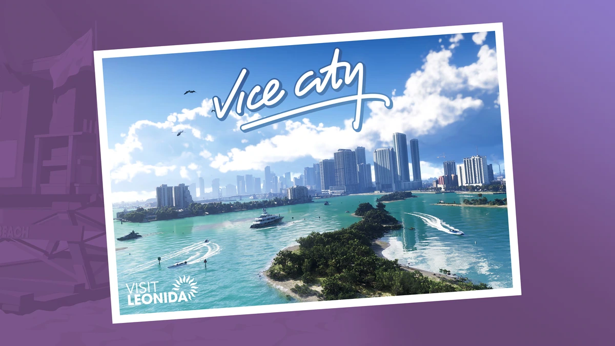
Rockstar’s official Grand Theft Auto VI pages name six places in Leonida: Vice City, Leonida Keys, Grassrivers, Port Gellhorn, Ambrosia and Mount Kalaga National Park. The media archive supplies promotional art and screenshots for several of them. That is a strong foundation for a reader’s mental map, but it is not a road map. There are no official district borders, travel times, collectible coordinates or complete route connections in those assets. Our first responsibility is to preserve the difference between a named setting and a fully charted playable space.
The six names already imply a useful editorial structure. A city, a chain of keys, wetland country, a Gulf-side town, a heartland and a national park point toward different visual and narrative registers. That observation describes how Rockstar labels and markets its locations; it does not prove how long a drive takes or what activities will appear in each place. A guide can discuss those contrasts without converting them into unsupported route advice.
Why regional contrast matters to pacing
Open-world pacing is partly a problem of contrast. A journey feels different when the view, sound, density and available decisions change along the way. In an editorial reading of the official region set, Vice City offers an urban reference point while the Keys and Grassrivers promise different landscape imagery. Port Gellhorn, Ambrosia and Mount Kalaga extend that range. Whether the released map makes those transitions fast or slow is a question for play, not for promotional art.
A map’s size alone says little about its rhythm. A compact world with sharply changing neighborhoods can feel more varied than a larger but visually uniform space. Conversely, a beautiful screenshot does not show how often a player crosses a region boundary, how missions use that boundary, or whether a journey can be interrupted. Those are the observations a proper review should measure after launch: route length, traversal choices, landmark readability, mission interruption and how frequently the world changes its visual language.
The map is a framework, not a promise
A named-region list can help readers organize screenshots. It can also tempt a guide writer to draw tidy boundaries that Rockstar has never released. GTA6Hint does not overlay invented county lines on official art or place pins by estimating a screenshot’s horizon. Our Leonida atlas keeps the source artwork and the status of every location visible. Until an official map or repeatable in-game observation exists, the atlas remains a visual index rather than a navigational instrument.
The same rule applies to claims about world activities. A visible boat, road sign, building or shoreline may prove only that it appears in that frame. It does not establish that the object is interactive, that a specific mission occurs there, or that a collectible sits nearby. Promotional images help readers recognize the game’s public visual vocabulary; a direct source is still needed before a landmark becomes a strategy instruction.
What we will measure when the game is available
A useful region guide should answer concrete questions. How does a player enter and leave the area? Which visible roads or waterways are usable? Are there safe routes that avoid a pursuit? Does the map mark services or must the player learn them? A walkthrough should name the platform and game version, describe a reproducible starting point, and distinguish the author’s route from the game’s objective wording. When the map supports coordinates, a guide should state how those coordinates were recorded.
For pacing analysis, we will record time between meaningful landmarks rather than simply claim that the map feels large. We will compare driving, walking and any officially available transport; log whether scenery changes gradually or abruptly; note how sound and traffic vary; and identify where story objectives pull players away from exploration. These observations make a review useful to people planning a session and give readers enough detail to challenge our interpretation.
Regional coverage without a false completion route
Before launch, the reliable way to follow the regions is to use Rockstar’s labels. Region pages can collect official images, source links and future corrections, while the news desk tracks new announcements. After release, each region can receive its own tested guide only when real activities have been identified in the game. That gives readers a place to return without filling it with guessed shops, fake collectibles or a map copied from an unverified post.
A 100% exploration route should explain its definition of completion. Some games distinguish story completion, collectibles, optional events, awards and platform achievements; a single percentage can hide those separate systems. We will use the game’s actual progress screens and published requirements rather than assume a familiar Grand Theft Auto pattern returns unchanged. The mission directory and hints hub are destinations for tested routes once evidence is available.
A reader’s checklist for evaluating map claims
When a map graphic appears online, ask who made it, when it was updated, and whether it cites a direct source. Compare its region names against Rockstar’s wording. Look for a visible version note and a method for locations. If it presents precise distances before a navigable official map or released-game capture exists, treat the numbers as estimates. If a post calls fan art an official map, check Rockstar’s media archive before sharing it.
This is not an argument against fan maps. Community cartography can be valuable when it labels uncertainty and records how a point was found. The problem is presentation: a polished graphic can make a conjecture look like fact. GTA6Hint credits guide-made diagrams, marks them approximate, and keeps official screenshots visually distinct. Readers should be able to tell whether an item is a publisher source, a tested player observation or an editorial hypothesis.
What this analysis can and cannot conclude
The six named regions provide an editorial outline for Leonida and a sensible way to organize source material. Their contrast may support varied travel, but only the released game can show how that rhythm works in practice. Rockstar’s public materials establish names, images and broad story context; they do not yet establish a complete route network or activity checklist. We will update this article when Rockstar publishes new map information or verifiable in-game evidence can be collected.
For now, use the official media archive to revisit source footage, the Newswire for dated announcements, and the map page for a clearly labeled regional index. If a location guide is marked tested, it should include platform, version and revision date. That standard takes longer than publishing every rumor, but it produces a resource readers can use without confusing promotional art with a coordinate.
Keep a guide that another player can follow
- Record the platform, game version, starting condition, and actual objective wording.
- Keep required steps separate from optional discoveries and editorial preferences.
- Describe the recovery point immediately after any step that can fail.
Field note: The completion roadmap is useful only when a requirement can be traced to the game’s own record or a reproducible result. Leave an uncertain total open.
Questions & answers
Is this a completed in-game route?
The page’s testing status defines its scope. A pre-release planning guide does not claim a completed campaign run.
Are chapter orders or collectible totals guessed?
No. A complete route needs a stated method and evidence from the released game or an explicit publisher source.
How can a reader report a mismatch?
Use the contact page and include the platform, version, starting state, and the step whose result differs.
Read our editorial policy for verification and corrections.
GTA6Hint is an independent publication and is not affiliated with Rockstar Games or Take-Two Interactive.